Hike to Blåisvatnet – Stunning Blue Lake Tromsø.
⤵️Hike Overview: Blue Lake (Blåisvatnet)
📍 Location & How to Get There
🌍 Where it sits: At the foot of the Lenangsbreen glacier near Sør‑Lenangsbotn on the Lyngen Peninsula (Northern Norway)
🚗 From Tromsø: Drive ~2.5 hours, including the ferry crossing from Breivikeidet to Svensby
🅿️ Trailhead: Off road Fv312 just past the junction with Fv314 in Sør‑Lenangsbotn. There’s a large parking lot with facilities (toilets, kiosk, etc.), payable via the EasyPark app (~254 NOK/day)
🥾 Trail Details
📏 Length: Approximately 8–8.8 km round trip (4–4.4 km each way)
⛰️ Elevation: Around 185–192 m maximum—mainly flat terrain
⏱️ Duration: Plan for about 3 hours return (1.5 h in, 1 h back)
🌿 Difficulty: Easy to moderate. Mostly flat but rocky riverbed—last section involves scree and boulders
🧭 Trail Markings: Follow red-topped stones or markers to stay on course
🌄 What to Expect
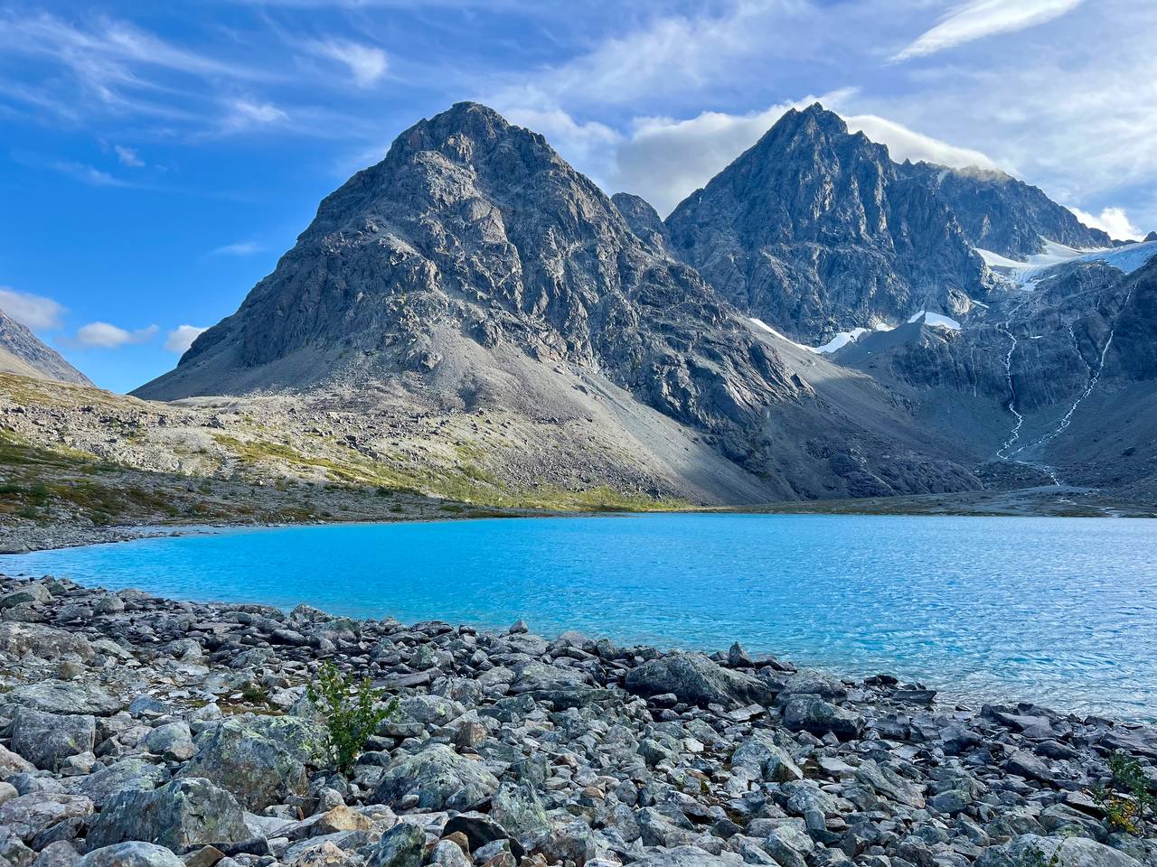
💎 The lake itself: A surreal, intensely blue/turquoise glacial lake that dazzles in sunlight
🏔️ Scenery: Dramatic steep rocky mountains framing the lake
❄️ Swimming: Allowed—but expect icy cold glacial water!
👣 Crowds: Popular on sunny days—but possible to find quiet spots lakeside
🍂 Season & Safety
🌞 Best time: Summer to early autumn (June–October)—for best lake color
⚠️ Winter caution: The lake is likely frozen until early June. Snowshoes/skis may be needed. Be avalanche-aware
🎒 Essentials: Good boots (ankle support), ~1 L water, snacks, warm layers, map/GPS, and prep for fast weather changes
🚌 Bonus: Guided Tour Option
If you’d rather not drive, some operators from Tromsø offer guided day hikes—including ferry, transport, and trail guide.